Finally!
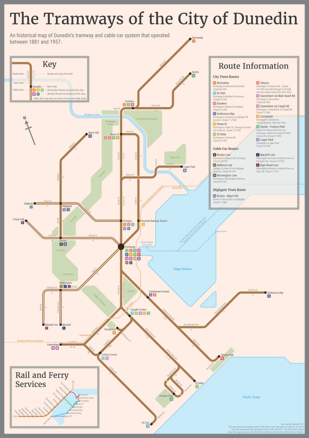
This is what I’ve been working on for the last half year. Many hours were spent in the Hocken Collections finding as much information as I could on the historical tram and cable car network that formed the backbone of Dunedin’s transportation system for so many years, and I’ve been sketching, creating and refining this map to show as much of that as possible.

The map features the cable lines, electric tram lines, railway services and ferry services that operated between 1881 and 1957 (although I did leave out the tram connection between Tahuna and St Kilda – this is because the route changed termini over its history and I chose to show the greatest extent which meant going to Tahuna Park instead of St Kilda).
There’s some great history surrounding the cable car network. Dunedin was the second city in the world (after San Francisco) to feature cable cars. Many of the engineers that helped build Dunedin’s system went on to share their advancements with cities abroad (such an advancement was the world’s first ‘pull curve’ outside St Joseph’s Cathedral). There are heaps of good books on the history of Dunedin’s trams and cable cars to be found at the Hocken Collections (and also these paintings).

Edit: There’s an error on the map! Incorrect route numbers on Princes St and I got my East and West the wrong way around! D:
