This is something I’ve been doing on and off for a few months now – maps of Dunedin’s existing and planned cycle facilities. It took me ages to get my head around using QGIS, and in the end I only used it to export a road and geography base layer (originally I wanted to include road names that I wouldn’t need to manually draw).
Here’s a map of Dunedin’s existing cycle network:

Earlier this year, the Dunedin City Council approved the next stage of the cycleway programme. Below is a map featuring the indicative routes in that report:

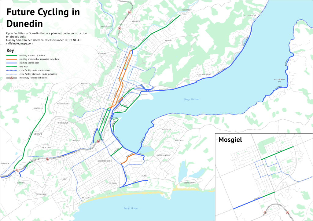
The above maps omit the small cycle lanes in Brighton, and the shared path and lanes out by Harrington Point. The below map shows the full extent of all cycle planned infrastructure:

Note the route on the left from Mosgiel to Dunedin – this will use two abandoned rail tunnels!
© 2019 Sam van der Weerden CC BY-NC 4.0
