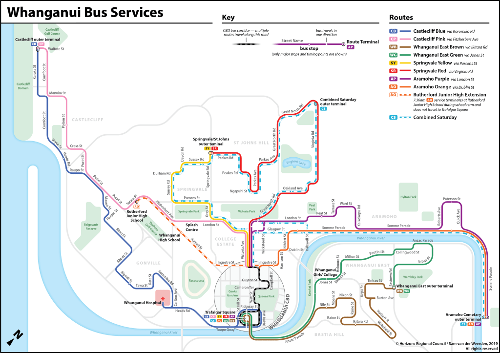
Horizons Regional Council — the authority that manages bus services for the Manawatū-Whanganui region of the North Island — reached out to me asking if I could put together a new bus map for Whanganui. The map Horizons was using was simple and utilitarian, and they were wanting a new schematic depiction like I did for Dunedin’s buses. After changes and iterations, this is what I produced in the end:

For context, the previous map looked like this:

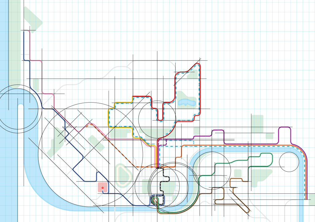
I started with an enlarged CBD view in the middle of a rectangular grid. As I gradually grew out the bus lines from the CBD, different sections lined up and some natural order to the layout began to arise. Fitting geographical features to this order, the new map (kind of) slots together like this:

As well as a system map, I also made a few smaller maps for the school bus services.


The previous system and school maps can be seen in this older timetable booklet. The new maps can be seen in this updated timetable booklet.
It was great fun working with a city layout I was so unfamiliar with!
