One of my 2021 New Year’s resolutions was to update this blog more frequently — ideally every fortnight. Oops.
I finished my maths Honours degree last year, having written my dissertation on topos theory and its relationship to intuitionistic logic. I’ve taken a break from academia for now, but I’m sure I’ll be back in the next ten years — non-classical mathematical foundations are too cool to walk away from!


After finishing my studies, I started a new job as a transport planner and cartographer. This, combined with a new time pressure on completing the maps for Can’t Get There from Here: New Zealand’s Shrinking Passenger Rail Network, 1920–2020 in time for going to print, has gobbled up my time.
However, inspired by Theodoræ Ditsek’s recent blog post, I thought I’d publish a list of maps I want to make and write about on this website. In part to help encourage me to work on them (after finishing the maps for the book), and in part just to the ideas out in the open.
So, in no particular order, my longlist of maps and some not-maps:
- A refresh of my Tāmaki Makaurau Auckland Tube Map, updating it with ferries, Te Huia, new ideas for light rail / light metro alignments, new future heavy rail service patterns, and bilingual text. DONE!
- A comprehensive map of Auckland’s integrated public transport system, showing all rapid and frequent bus, train and ferry services. Auckland’s PT is a marvel of network design in how the different modes complement each other, but it’s not often (or ever) displayed as a single network. For instance, Auckland Transport’s own integrated system map doesn’t even show train services — only the tracks on which they run.

- A redesign of Auckland’s real time information screens, especially the huge one in the central Britomart Station. It doesn’t show line names, only destinations.
- A map for the new Te Huia commuter train from Kirikiriroa Hamilton to Auckland.
- An update of my Air New Zealand routes map with the current network, adding small operators like Air Chathams and Sounds Air. DONE!
- A transit map of Intercity’s coach network. Maybe in the style of something, or maybe just as a sketch.
- An update of my Ōtepoti Dunedin bus map. Man oh man, I keep pushing this one off — I think I just need to restart it from scratch at this point.
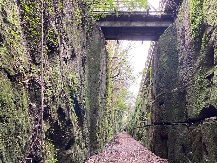
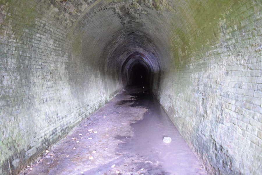
- A small nifty map of the Dunedin to Mosgiel cycle tunnel trail. Mosgiel is a satellite town of Dunedin, and every weekday 5,000+ people drive the 20 minute journey over a couple of hills into town. Flattening out this journey for cyclists using the old rail corridor would do wonders for opening up access for active mode.
- A digital recreation of a beautiful old map of Rotterdam’s trams (shown below). This was designed by Tel Design, the same company behind the iconic branding of the Dutch Railways (NS).


- A series of stupid and fun ideas of future Dunedin public transport, from ferries and busways to metro lines and gondolas.
- A map of the old tram, cable car and ferry network in Te Whanganui-a-Tara Wellington.
- A New Zealand state highways transit map. Ever since Andrew Douglas-Clifford made his famous map I’ve been keen to try my hand at the same network.
- An Ōtautahi Christchurch cycleway transit map. It’s a pretty comprehensive network and could work well as a schematic.

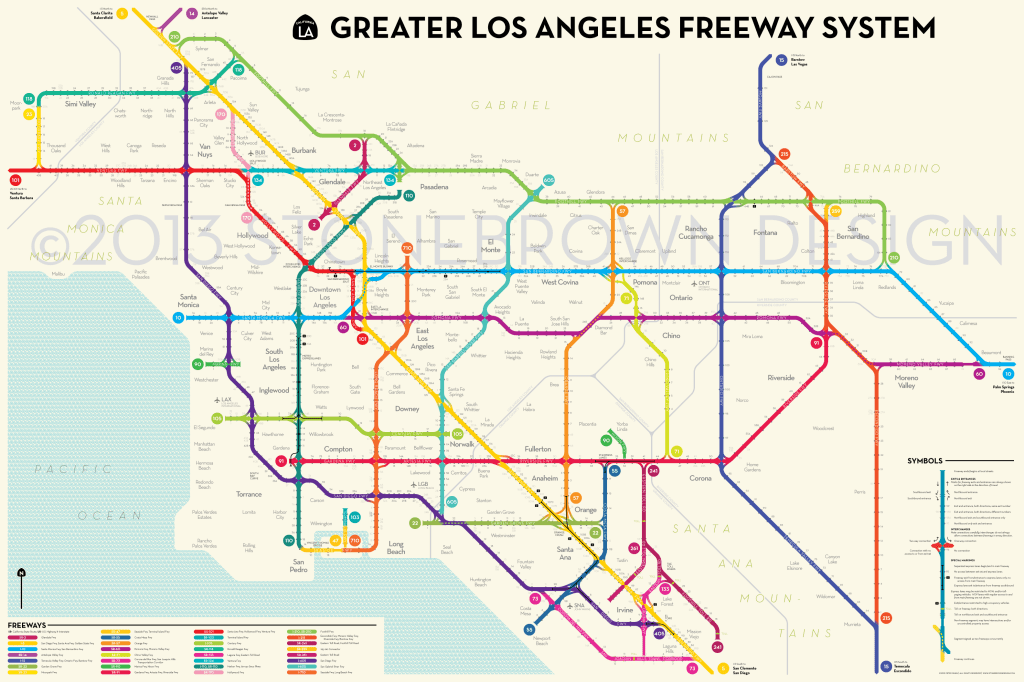
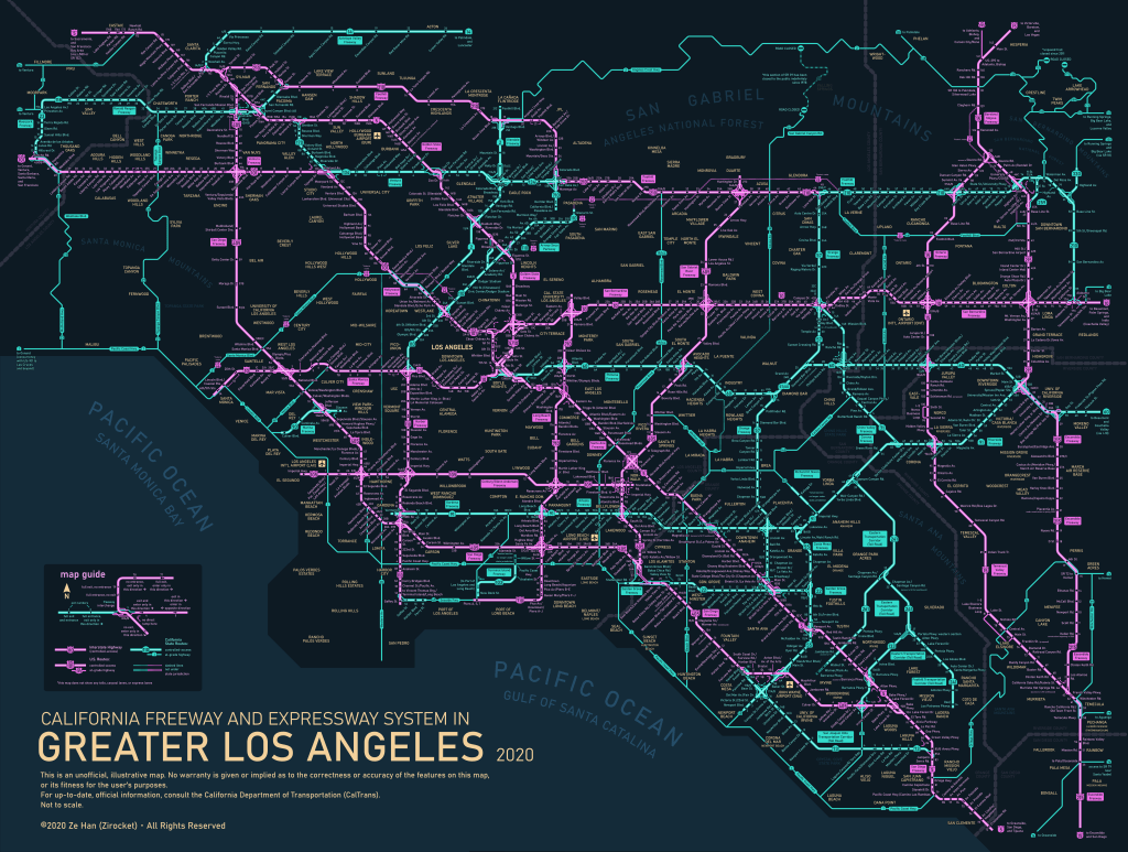
- An Auckland motorways transit map, inspired by the below transit maps made of Los Angeles’s freeways (although it’d be much simpler).
- Transit maps of various New Zealand tramps
So, fifteen in total! A couple of things to note:
- Almost everything on my longlist is in Aotearoa NZ. I’ll get around to the transit map rite of passage (London) soon, but for now I’m happy mapping my own backyard.
- I aim to be better with the use of dual naming in te reo Māori and English, and so going forward I’ll try to work bilingual elements into my maps.
- There’s no guarantee I’ll finish all of these maps, or even just one. This list doesn’t have a deadline.
I’ve also completed a few transit maps as part of projects at work — I’m looking forward to sharing them when they go public.
That’s me for now, hopefully you’ll see a new post here soon!
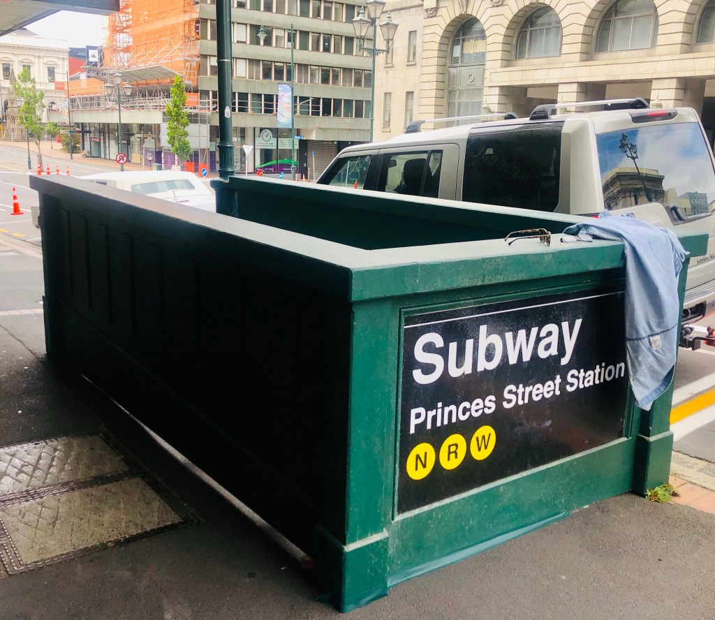
To finish: Netflix was in town recently filming something set it New York, which meant we got subway entrances and NYC yellow taxis popping up around town. Neat stuff.
