While working at Stantec, I created some maps for the Wellington Rail Programme Business Case to:
- Plot the existing passenger rail network and its relationship to geography, roads and wider railway lines
- Highlight where major areas of growth and congestion are expected to occur
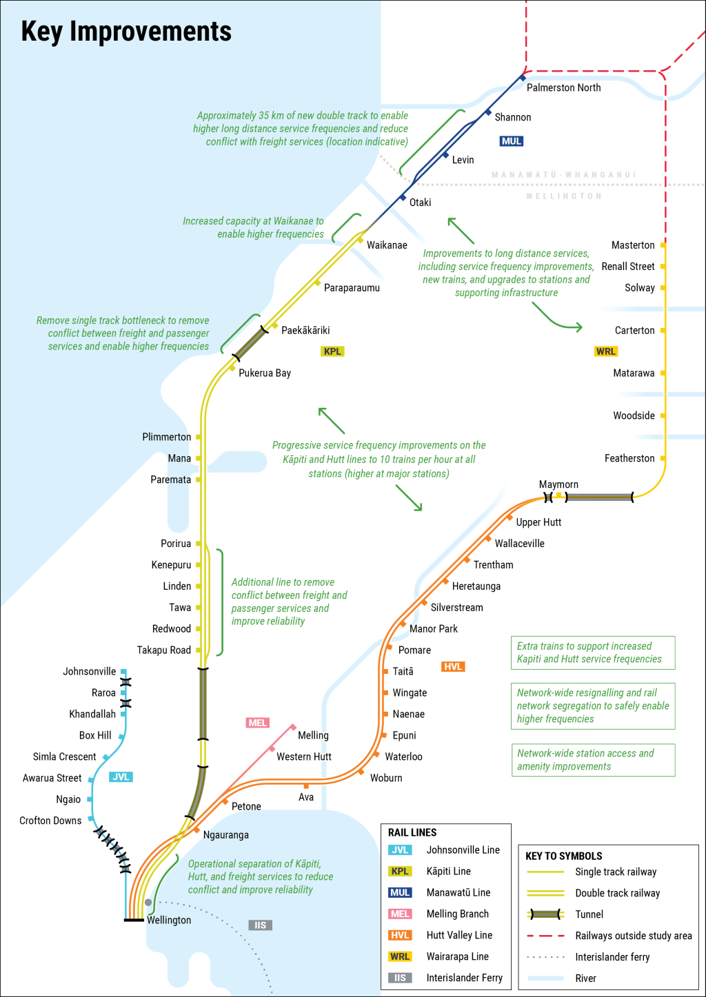
- Outline key improvements recommended through the business case
I think these maps also do a pretty good job as general Metlink passenger information maps too!


The report can be found on page 23 of these regional council agenda items.
