
One of the last projects I was involved in when working at Stantec was developing the Tauranga City Centre Action and Investment Plan — a 10 year action plan and 30 year strategy to revitalise Tauranga City Centre and make it the beating heart of the Western Bay of Plenty once again.
I was working on movement element of the Plan — how to future proof the transport network to enable a more accessible and more pleasant public realm in the coming years and decades. It was a tonne of work and I’m really proud of where we ended up. You can read the final plan here.
The Maps
In addition to the transport planning technical work, I also led the mapping side of the Plan. It’s a fundamentally geographic piece of work, so there was a reliance on good quality cartography to communicate the context of the city centre, and the future vision for transport, public realm, and development.
Historical Context
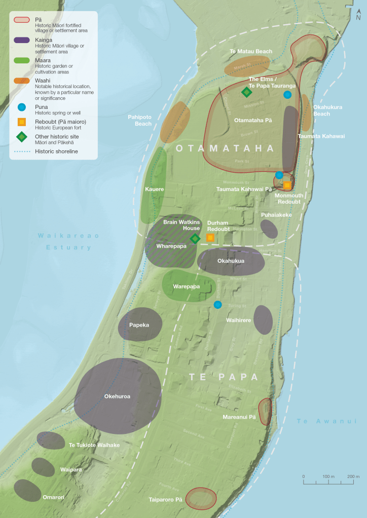
The Te Papa peninsula has an extensive history of being a place for people to grow food, learn, and live. From the plan:
Since the preordained arrival of the great voyaging vessel Tākitimu, Te Papa has been a haven for many waka and their people. Located at the epicentre of the great harbour now known as Tauranga Moana, Te Papa has seen the continued tradition of landing and anchoring waka upon and off its shores. Tangata whenua were drawn to the headland seeking a great life. The special qualities of Te Papa and the intentional relationship between people, whenua and moana, enabled this great life to be sustained. It is the position of mana whenua that the ancestral relationship between people and the whenua continued beyond the loss of the land through the raupatu, or land confiscations, of the 1860s.
Te Papa remains a home for many. Early Māori numbered in their thousands in Otamataha and Te Papa, and Te Papa was a buzzing metropolis and hive of activity. Its people basked fishing nets in the sun, gathered the many crops of the area, traded and exported goods, and thrived as a community. Te Papa is where relationships were strengthened, and the holistic well-being of the people was priority. Here, education was paramount to ensure the intergenerational transmission of traditional and newly acquired knowledge, as Te Papa was the interface of Māori and Western society.
The blue dash in the below map shows the pre-colonial extent of the land before large areas were reclaimed from the sea.
Key Moves
We needed a punchy map full of the big things to be excited about. Two of these big things are Te Manawa Huanui — a pedestrian focussed spine through the city centre, and the rapid bus spine — a consolidated, high-frequency, prioritised corridor for all buses to use. The two transport spines parallel and cross each other, and are highlighted throughout the plan.
The playful symbology and colour of this map also helps communicate the plan’s livelihood and energy.

The Precincts
A cornerstone of the plan are the precincts — eight areas with distinct existing and future land uses, character and identity. From the text:
- Cultural and Historical Precinct
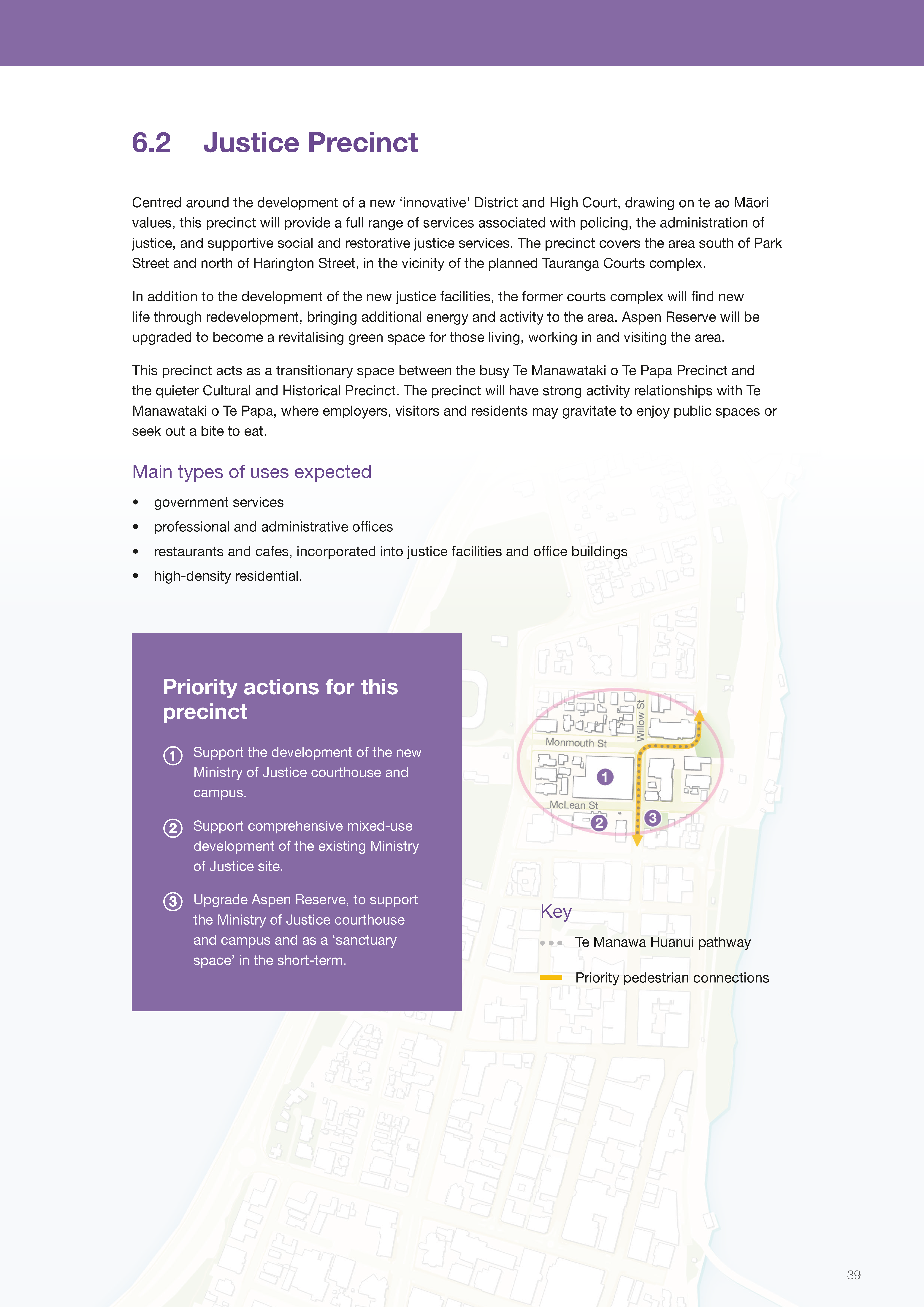
A place for people to visit and explore important historical and cultural places and facilities reflecting the long history and deep cultural heritage of Te Papa and wider Tauranga.- Justice Precinct
Centred around the development of the new Tauranga District and High Court complex, this precinct will provide a full range of services associated with policing, the administration of justice, and supportive social and restorative justice services.- Waterfront and Taumata Kahawai Precinct
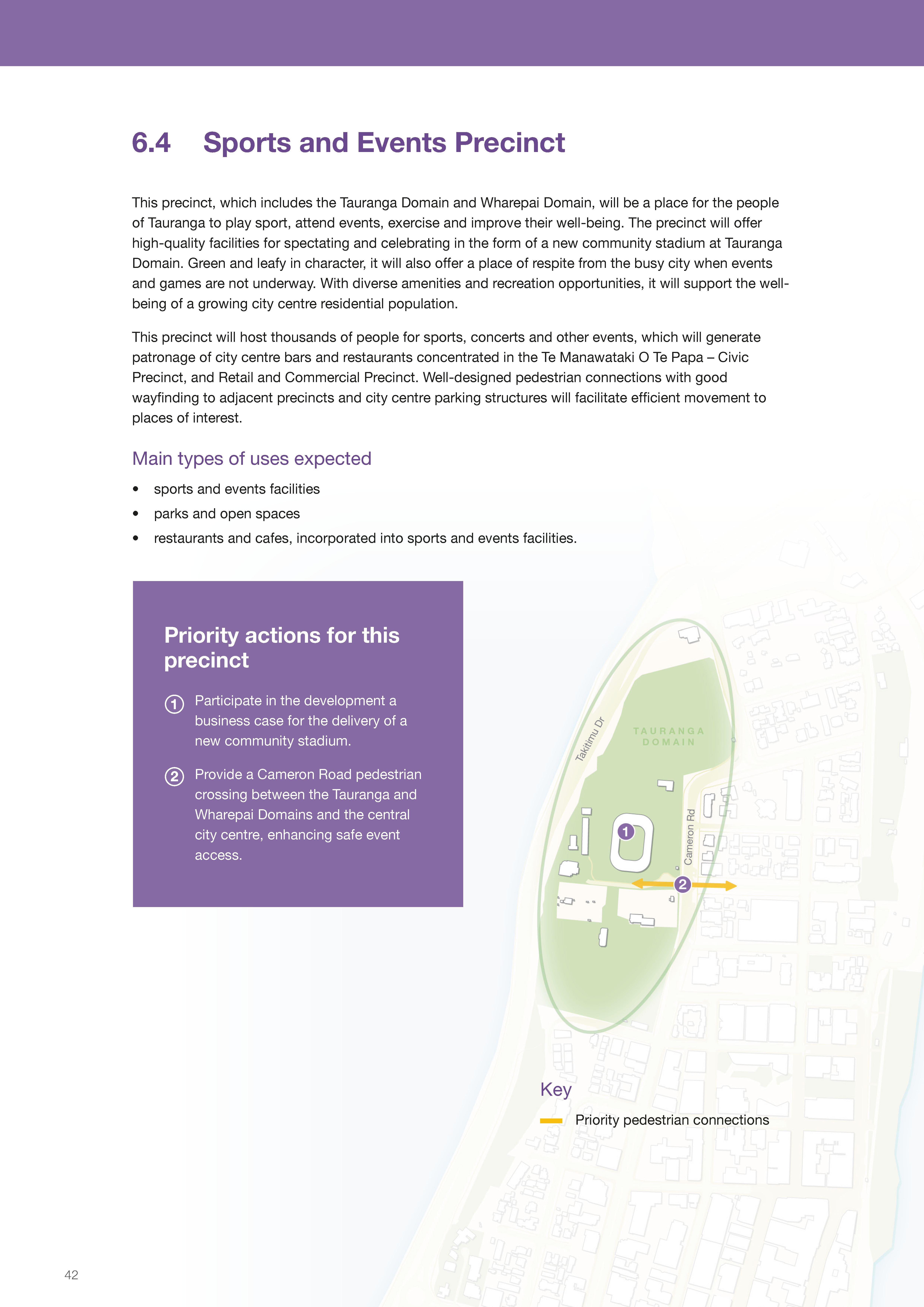
The connecting point between the city centre’s whenua and moana. This precinct will become a premier recreational destination, improving access to marine activities and recreational activities on the water’s edge, and celebrating our city’s deep cultural connection with Tauranga Moana.- Sports and Events Precinct
A place for the people of Tauranga to gather for sports and events, and to exercise and enjoy public open space.- Te Manawataki o Te Papa – Civic Precinct
The cultural and community heart of the city centre: a proposed cluster of facilities that would sit alongside the existing Baycourt and Art Gallery, including a new library and community hub, civic whare (a venue for council and community meetings), and museum and exhibition/events space, supported by the vibrant hospitality scene in the surrounding streets.- Retail and Commercial Precinct
The core of the city centre’s retail and office offerings. Boutique retailers line the streets, as well as restaurants and cafes. Above street level, offices, apartments and hotels bring the concentration of people to make the streets full of life, and bring customers to the shops and services.- Knowledge Precinct
A ‘campus within the city’ with up to 5000 students, concentrating educational facilities and related uses such as research offices and student residences, close to each other.- Mixed-Use Precincts
These precincts will contain an eclectic mix of activities. At the ground floor, a diversity of land uses including retail, cafes and restaurants, office and service businesses will be used by the upstairs tenants, and residents of mid-rise and high-rise office and residential buildings.
A simple map shows these eight precincts. Smaller, more detailed maps show priority actions to support the specific outcomes of each precinct (pages 38 to 47).


Movement Framework
The final two maps relate to the movement and access framework: a strategy for future-proofing and enhancing the transport network in the city centre to enable many, many more people to live, work, and visit while maintaining quality public realm (i.e., not dominated by private vehicles). From the plan’s text:
Tauranga is on a journey from a car-oriented past to providing a richer and more sustainable range of transport choices. The city centre, as the single biggest journey destination in the western Bay of Plenty, has a key role to play. Key elements that will help shift the way people choose to move around the city centre are:
- Prioritised routes and supporting infrastructure for walking, cycling and public transport
- An all ages and abilities universal design approach
- A slow pedestrian core in the city centre
- A city centre as a place to travel ‘to’ rather than ‘through’
- A managed approach to all networks prioritising needed access
- A move to a demand-based parking management approach
The maps below show the envisioned multi-modal transport network. A major component are the five general vehicle access areas (traffic cells) which maintain vehicle access but limit through-movement. This is the enabler of increased public transport, walking and cycling access and safety.


Implementation…!
The council and commission have expressed great support for this plan, so I’m looking forward to seeing how it get implemented over the next decade!
